Showing posts with label Civil War Trails. Show all posts

Thursday, March 12, 2015

A Snowy Hike on Antietam's Three Farms Trail

This past weekend I traveled through Maryland and Pennsylvania, and on Sunday morning I spent a few hours at the Antietam National Battlefield. After nasty weather over the past several weeks, Sunday turned into a beautiful, spring-like day; perfect for a hike on Sharpsburg's snow-covered fields.

The Antietam National Battlefield has established excellent hiking trails for the intrepid battlefield tourist. The park's trail system allows a visitor with enough time and stamina to explore the entire battlefield, from the North Woods to Snavely's Ford, on foot. On previous visits, I had explored many of these trails. On Sunday, with only a few hours to spare, I decided to seek out one that I'd not previously experienced.

The Three Farms Trail does not explore areas where intense combat took place during the Battle of Antietam. However, it takes hikers to some of the quietest and most beautiful locations on the battlefield.As its name implies, the path winds its way through three farms that existed during the 1862 battle. It begins at the William Roulette farm, and passes through the secluded fields and buildings of the Joseph Parks and Joshua Newcomer farms. As you make your way south along the west side of Antietam Creek, you pass over terrain traversed and occupied by elements of the 2nd and 5th corps of the Army of the Potomac during the battle on September 17th, 1862.

A view taken from near the Visitor Center on the Dunker Church Plateau looking toward the Mumma (left) and Roulette Farms (right), and beyond to the South Mountain Range. The Mumma Farm Lane runs across the middle of the view.

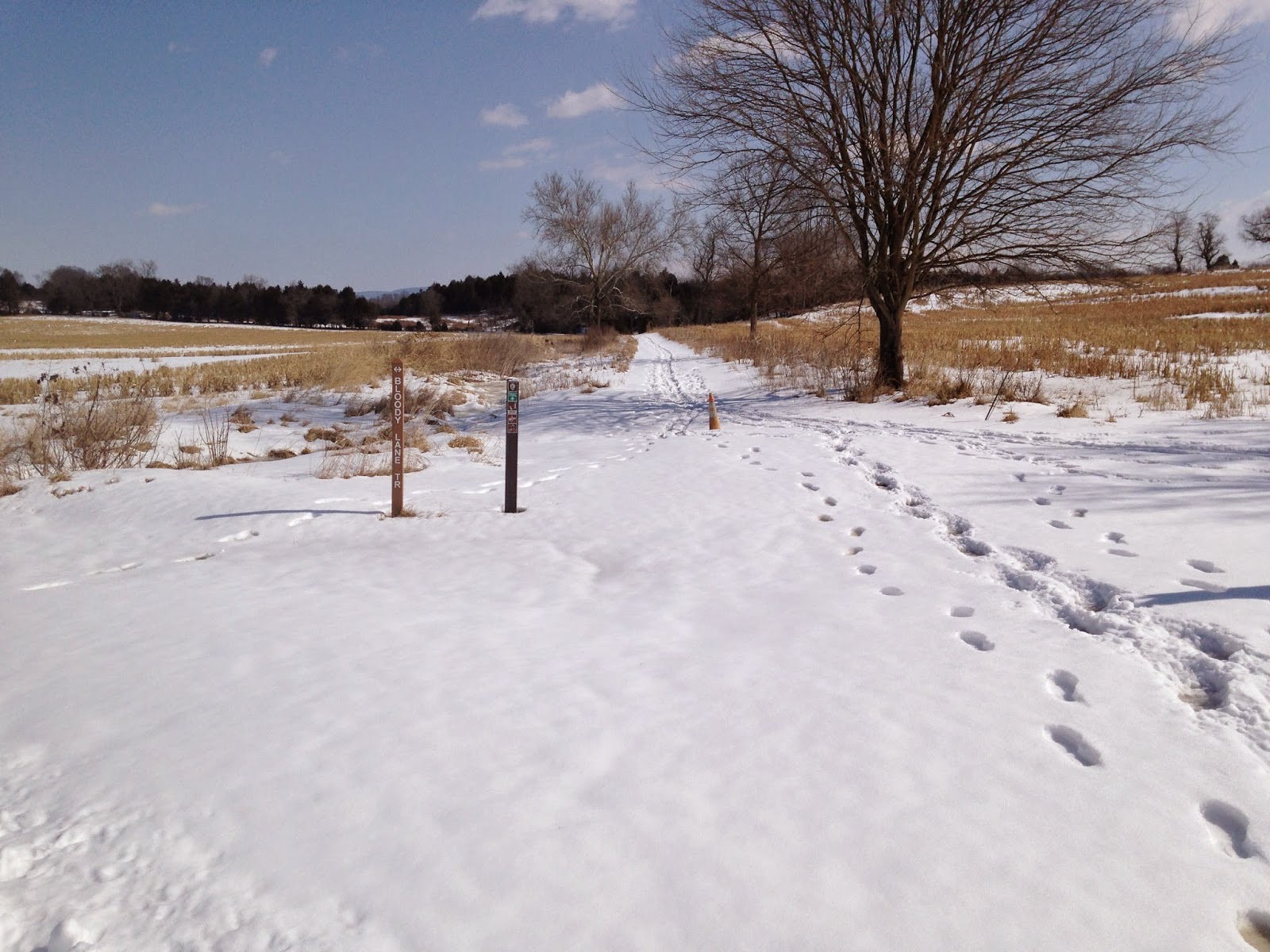
You cannot access the trail head readily via car. First, you must hike a portion of the Bloody Lane Trail which begins at the Visitor Center, and visits the Mumma and Roulette Farms. More than 5,000 United States soldiers commanded by Brig. Gen. William French passed over these farms on their way to attack Confederate forces in the Sunken Road on the morning of September 17th.  

The Battle of Antietam brought a great deal of suffering to the Roulette Family. Their farm endured extensive damage as a result of the thousands of soldiers that tramped over it. During the battle the farm became a field hospital, and William Roulette later claimed that some 700 soldiers were buried on his property. The family's youngest daughter, Carrie May, later died of a disease likely brought by the armies.


A second view of the Roulette Farm House and its springhouse and kitchen.
This view was taken from the ravine through which French's division emerged onto the battlefield.


After passing these farm buildings, the Bloody Lane Trail follows the Roulette's old farm lane. The start of the Three Farms Trail is found at the location where the farm lane curves to the southwest.

The Roulette Farm Lane can be seen in the foreground. In the distance, the Bloody Lane observation tower rises up above the ridge line. Cresting that ridge, United States soldiers recoiled from a withering fire delivered by Confederates resting in a sunken road on the opposite slope.
The trail head for the Three Farms Trail leads to the northeast away from the Bloody Lane.

The Three Farms Trail connects Antietam National Battlefield's northern and southern trail networks. From the Roulette Farm, it winds its way southward, part of the way along Antietam Creek, until it connects with the Sherrick Farm Trail south of the Boonsboro Pike, modern day Route 34.


This rutted road trace remains visible on the landscape today. In 1862 it connected the
Parks, Newkirk, and Kennedy Farms to the Boonsboro Pike near the Middle Bridge over Antietam Creek.
Along the way, the recreational trail joins the deep-cut trace of an old roadway as it makes its way toward the Joseph Parks farm. In 1862 this road connected the Parks Farm with the Boonsboro Pike to the south, and the Kennedy and Newkirk Farms to the north.

The Joseph Parks Farm today. Both the barn and the home in the background date to the 1830s, though both have seen alterations over time.

Eventually, the path climbs a hill and emerges into a clearing occupied by the historic buildings of the Joseph Parks Farm. According to a Cultural Landscapes Inventory completed by the National Park Service in 2011, both the main house and barn were initially constructed around 1830, though both have undergone alterations. This land was long owned by the Mumma Family, who originally built the house and farm buildings. In 1861, the Mummas sold the farm to Phillip Pry. Pry owned another farm on the opposite side of Antietam Creek, which became Maj. Gen. George McClellan's headquarters during the battle. Pry operated this property as a tenant farm, and historians believe that the tenant at the time of the battle was Joseph Parks. On September 16th, United States Soldiers crossed the creek near the farm to protect the middle bridge. The following day, Union infantry and cavalry traversed the property, artillery batteries established positions on the farm to fire against Confederate positions on Cemetery Hill, and its likely that the homestead became a field hospital. Just five days after the Battle of Antietam--photographer James F. Gibson captured a view of the Parks farmstead in a view entitled "Antietam, Md. Another view of Antietam Bridge."
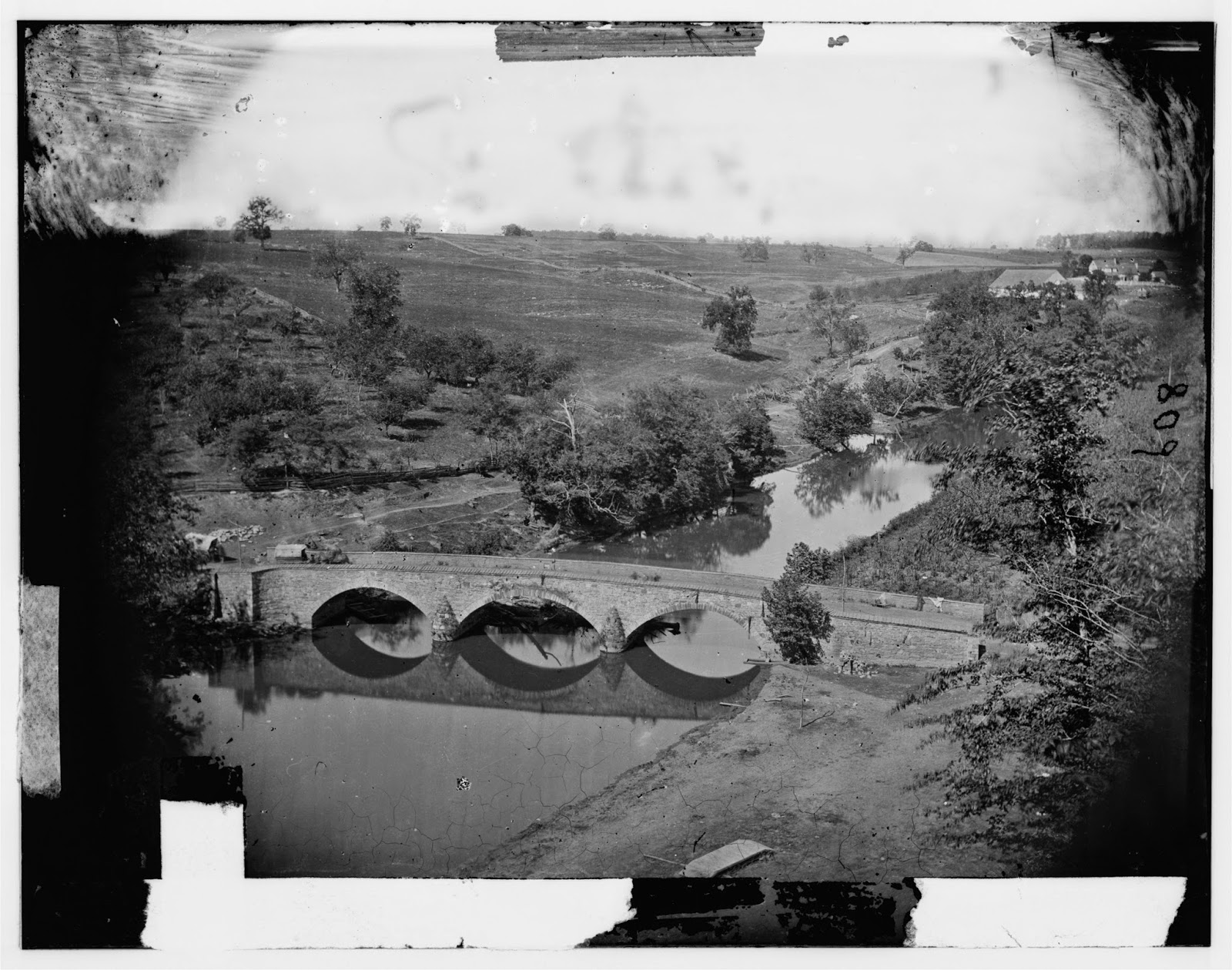
Gibson photographed the Parks Farm from heights on the eastern side of Antietam Creek,
overlooking the Middle Bridge.
A zoomed-in view of the previous photograph, focusing on the Joseph Parks Farm.
The house and the barn still stand today.

Moving on from the Parks Farmstead, I neared the Boonsboro Pike. Here the trail continues on past the Newcomer Farm, crossing the pike to eventually link with the Sherrick Farm Trail. Instead of completing the trail, I chose to turn aside here onto the Tidball Trail, which ascends a steep ridge line to the position of Captain John C. Tidball's Battery A, 2nd United States Artillery during the battle.


After crossing the Middle Bridge before noon on September 17th, Tidball's men hauled their six rifled cannon by hand up this steep ridge, where they expended some 1,200 rounds of ammunition protecting federal troops positioned near the Bloody Lane and supporting Burnside's advance to the edge of Sharpsburg that afternoon.

The views obtained from Tidball's position, I think, are some of the best you will find on the Antietam Battlefield. From this one position you get a good view of the terrain over which the 2nd Corps assaulted the Sunken Road, the ground over which Burnsides' 9th Corps advanced in late afternoon against the Confederate right, and an imposing view of the rolling, open terrain that McClellan's soldiers would have had to cross to attack the Confederate Center on the outskirts of Sharpsburg. Many--including myself--have criticized George McClellan for not crossing his reserves over the Middle Bridge on September 17th to attack Lee's center when one more push could have potentially crushed Lee's army. Viewing the terrain from this vantage point, however, I saw the tremendous obstacles to such a movement.

The Antietam Battlefield is surprisingly compact, but the rolling nature of the terrain rarely allows you such a sweeping view of the battlefield. Here are a few of the shots that I snapped in this location:

From the ridge line looking back toward the Parks Farm.
Another view of the Parks Farm. I took this picture as I ascended the ridge line toward Tidball's position.
A view from Tidball's position toward the surprisingly close Bloody Lane Observation
Tower, just four-tenths of a mile away.
A view looking southwest across the Boonsboro Pike toward Antietam National Cemetery
(marked by the evergreen trees on the hill in the right background).
A close-up view of Cemetery Hill - with the National Cemetery to the left of the road.
Lee's center rested on that ridge line on September 17th, 1862.
A zoomed-in view looking southwest toward where the final advance of Burnsides' corps was turned back by Confederate reinforcements. The distant hill in the left background marked the farthest advance of the 9th Corps.

Running short on time. I did not complete the Three Farms Trail after viewing Tidball's position. Instead, I struck out across country to the Bloody Lane, and completed my hiking circuit back to my car at the Visitor Center. After a brisk two-hour hike, I started back on my way home to Virginia. If you have the time, hiking is the only way to truly understand a battlefield like Antietam, and the Park Service has done a great job creating these trails that provide access to the under-visited locations on the field. The different views and terrain features you will observe while hiking will likely change your perspective of the battle.

Tuesday, March 3, 2015

Morning Fog at the Mule Shoe - Spotsylvania

Yesterday I took advantage of warmer temperatures to accomplish some hiking at Spotsylvania and Chancellorsville battlefields. Here are a few photos:


In the morning I had the Mule Shoe Salient essentially to myself, excepting a herd of deer grazing in the hollows and depressions in front of the Confederate works. It's hard to believe that some 151 years ago, this now-quiet spot was the ugliest place in America.


Sunday, July 6, 2014

Exploring Kelly's Ford and Brandy Station

Just about a year ago last week I found myself in Gettysburg, Pennsylvania with thousands of others commemorating the 150th anniversary of the largest battle of the Civil War. I didn't make it for the battle anniversary this year, but my thoughts turned to Gettysburg, nonetheless. Last Monday, I decided to commemorate the campaign in a different manner, by taking my first trip to the site of its opening battle: Brandy Station.

Armed with driving tours put together by Fredericksburg & Spotsylvania National Military Park, I began my excursion with a visit to Kelly's Ford on the Rappahannock. Modern route 620 crosses the river about 300 yards upstream from the ford. Just before the bridge is a parking lot and a boat launch operated by the Virginia Department of Game and Inland Fisheries.

Rappahannock River at the Kelly's Ford Boat Launch. This is actually the site
of an old mill. The ford is 300 yards downstream.

The ford can be reached by following a well worn footpath along the river. A sign delineates its actual location.

Kelly's Ford.

Kelly's Ford served as a vital crossing during the war. In March of 1863 a small cavalry action took place here when 2,100 troopers and six cannon under the command of Brigadier General William Averell  forced their way across the river and engaged Confederate cavalry led by Brigadier General Fitzhugh Lee. Interpretive signs placed by the Civil War Trust near the ford explain the significance of this small action. Kelly's Ford also served as the crossing site of David McMurtrie Gregg's column of cavalry on the morning of June 9th, 1863, on its way to Brandy Station.

After working my way down to the actual site of the ford, I retraced my steps, got in my vehicle, and followed the NPS's driving tour for the Battle of Kelly's Ford. A portion of this battlefield is preserved as part of the Phelps Wildlife Management Area, including the location of the mortal wounding of the Confederacy's young and talented horse artillerist, Major John Pelham. After completing my brief tour of the Kelly's Ford battlefield, I moved on just a few miles to the Brandy Station Battlefield Park, site of the largest cavalry battle of the war.

On the morning of June 9th, 1863, Major General Alfred Pleasonton had orders to take a force of 8,000 cavalry and 3,000 infantry, cross the upper Rappahannock River, and "disperse and destroy" the enemy's cavalry. Pleasonton's forces crossed in two columns - John Buford's right wing crossed at Beverly Ford, while David McMurtrie Gregg took his troopers across at Kelly's Ford, six miles downstream. Believing Stuart's forces to be in the vicinity of Culpeper, the federals intended to link up at Brandy Station. Instead, they ran into Confederate resistance immediately.  When Gregg's column got off to a late start, Buford found himself fighting on his own on the south side of the Rappahannock shortly after dawn.

At his headquarters on Fleetwood Hill, a tall ridge near Brandy Station that dominated the surrounding landscape, Stuart was surprised by Buford's advance. Reacting quickly, he road to the northeast and established a strong defensive position along a ridge near St. James Church. After several hours of intense fighting on this front, things for Stuart looked under control until reports arrived indicating that Gregg's command was advancing up from Brandy Station in the Confederate rear. Rebel troopers rushed back to defend Fleetwood Hill, arriving in the nick of time. The hill became a witness to wild scenes of charges and counter charges, as the two foes struggled for its possession for the next five hours.

Eventually, Pleasonton realized that he did not have a force sufficient to destroy Stuart's command and withdrew his men back across the Rappahannock. In later years the federal cavalry chief would claim that he had uncovered the important intelligence that Lee's army was invading the north, but the reality is that Pleasonton failed to discover the presence of Confederate infantry nearby. And yet, despite failing in their principle objective of dispersing and destroying Stuart, and failing to discover evidence of Lee's movements, the federal cavalry earned a significant mental victory at Brandy Station. Out-fought throughout the war up until this point by their Confederate counterparts, on this battlefield they had stood toe-to-toe with their enemy and had proven that they could match them.

Today, Brandy Station stands as a preservation success story, as this recent article from the Civil War Trust reveals. The battleground stood nearly untouched, yet unprotected into the 1980s. From the late 1980s through the early 2000s, a succession of developers threatened the battlefield. Local and national preservationists rallied to resist each attempt, including plans for an office park and plans for a Formula One racetrack. They fought off each crisis, and eventually began to buy up and protect the land, little by little. In 2003, the Civil War Trust and Brandy Station Foundation were able to open the Brandy Station Battlefield Park. Perhaps the culminating moment came last year - when the Civil War Trust was able to purchase 56 acres atop Fleetwood Hill, the critical ground at the center of the battle. Today, the central core of the battlefield (1,860 acres) has been preserved.

I began my tour of Brandy Station by pulling my car off the road on Route 685 (the old Carolina Road) at a location that provides a nice vantage point from which to view Fleetwood Hill. Here two interpretive signs related "The Race for Fleetwood Hill" and "The Struggle for Fleetwood Hill." The high ground served as Stuart's headquarters during the battle, and as the highest eminence around, it was the key terrain. With its recent acquisition, I hope that the Civil War Trust will soon open up a hiking trail here with interpretive signage, as they have done so well in other locations at Brandy Station, and on other battlefields. For the time being, there is not much more to explore in this location, at least for someone unfamiliar with the battlefield, as I was.

Leaving Fleetwood Hill, I traveled northeast and turned onto the Beverly Ford Road, modern route 676. After passing by the Culpeper Regional Airport, I turned left into the Battlefield Park and left my car to enjoy the Buford's Knoll Interpretive Trail. This two mile out-and-back hike contains four interpretive markers.


The first markers describe Buford's initial advance along the Beverly Ford Road, the Confederate response, and the death of Colonel Benjamin "Grimes" Davis as he led the Union advance that morning.


After reading these signs I followed a mowed path that connected in with a gravel road. Hiking north the trail crosses Ruffan's Run and ascends a knoll used as a command post by General Buford. Here I found the trail's final two stops. These signs described Buford's attempt to swing his forces north and west around Stuart's left flank, and Rooney Lee's skillful use of terrain to block Buford.

Looking from Buford's Knoll toward the position of Rooney Lee's Confederate troopers.

After retracing my steps I hopped back in the car, drove a short distance on the Beverly Ford Road, turned right onto the St. James Church road, and arrived at the St. James Church Walking Trail. This five stop, one mile hike interprets the fighting around the church, where Stuart set up his initial defenses against Buford on the morning of June 9th. A few stops on the trail also discuss the Army of the Potomac's occupation of Brandy Station in the Winter of 1863/1864, and its encampments there.

The ground crossed by the 6th Pennsylvania Cavalry in their charge. In the distance you can just make out the
rise of ground just above the lower tree line that was occupied by Confederate artillery.

Part of this trail covers the ground crossed by the 6th Pennsylvania Cavalry on the morning of June 9th, as they charged into the very teeth of sixteen pieces of rebel artillery located along a plateau near St. James Church. The 6th Pennsylvania made it to the very muzzles of the guns, but were driven back with heavy losses. The regiment suffered more casualties than any other at the battle.

In all, I spent about half a day exploring Brandy Station and Kelly's Ford, and could have spent more time had it not been for the brutal heat and humidity. The same open fields that allowed for easy maneuvering of mounted troops left little shade for me. The Brandy Station battlefield is in an excellent state of preservation. With its rolling farmland and sweeping vistas, the ground seems as if it were an amphitheater especially designed for the largest cavalry battle of the Civil War. If you find yourself in Central Virginia and looking for a lesser-known battlefield to visit, Kelly's Ford and Brandy Station are both worth exploring.

Monday, May 19, 2014

A Visit to the North Anna Battlefield Park

Monument at the beginning of the Ox Ford Trail.
I've lived in Virginia for almost eight months now - and I haven't even begun to scratch the surface of the many battlefields within a short drive.With a beautiful Monday off from work, I decided to continue my recent exploration of the Overland Campaign with a trip to the North Anna Battlefield Park in Doswell, Virginia. This park preserves a small portion of the North Anna Battlefield, and is not run by National Park Service, but rather by Hanover County Parks and Recreation. This relatively obscure destination contains some of the best preserved Civil War entrenchments you will see.

Ulysses S. Grant and Robert E. Lee had battled each other to a stalemate at Spotsylvania Court House after nearly two weeks of fighting between May 8th and May 19th. Concluding that Lee's lines were too strong to carry by assault, Grant decided to move the Army of the Potomac again. On the night of May 20th, he sent the 2nd Corps on a twenty mile march to the south and east in an effort to threaten Lee's communications, and to pry Lee out of his entrenchments in pursuit. The maneuver succeeded, and the following day the roads leading south and east from Spotsylvania filled with the long columns of both armies. On the 22nd - the Army of Northern Virginia crossed over the North Anna and came to a halt. The south bank of this river provided a strong defensive line, and just below it ran the Virginia Central Railroad, Lee's critical link to the Shenandoah Valley. He chose to make his stand here.

On May 23rd, the Army of the Potomac closed to river, and secured two crossings, with the 2nd Corps securing Chesterfield Bridge on the Army of Northern Virginia's right flank, and the 5th Corps crossing upstream at Jericho Mills on Lee's left flank. Late in the day a Confederate counterattack failed to drive the 5th Corps back to the north side of the river. With his enemy across the river in two places, Lee devised an ingenious defensive line. He pulled back both wings of his army into strong natural positions so that his lines resembled an inverted V. The apex of his V stood on an imposing and unassailable bluff overlooking Ox Ford on the river, with both legs of his line running away from this point to the southeast and southwest. Having quickly learned the value of earthworks in this campaign, on the evening of May 23rd the Confederate army set to work building elaborate entrenchements all along their strong position. If they could hold the impregnable apex of their line at Ox Ford, the Army of the Potomac would be divided by the river at any point when assaulting Lee's lines. Because of a bend in the river at this point, Union forces on one flank would need to cross the river twice to come to the support of forces on the other flank. Lee hoped that this unique formation would allow him to concentrate his army quickly against one wing of the Army of the Potomac and crush it before help could arrive.

Timothy O'Sullivan photographed Quarles's Mills in late May 1864. Portions of the 9th Corps
crossed near here on May 24th.
Having gotten forces across the river at two places the previous evening, when they awoke on May 24th Grant and Meade assumed that the Confederate army had retreated during the night. They quickly ordered their forces to pursue - unwittingly putting their army into the jaws of Lee's trap. Yet Lee lay bedridden on this day, ill with dysentery. His high command had been decimated over the campaign to this point, and Lee had few subordinates he felt he could trust with an important offensive operation. Instead, he chose not to spring the trap if he could not lead it himself. Union forces probed and in some cases assaulted Lee's strong works - eventually figuring out that the Confederate army was not in retreat. They entrenched themselves and once again the campaign reached a stalemate. Grant would have to maneuver yet again if he wanted to defeat Lee.

Confederate entrenchments with a traverse.
The North Anna Battlefield Park preserves a good portion of the western leg of Lee's earthworks, extending all the way up to and including the apex of the Confederate line overlooking Ox Ford. Currently, there is a ten stop, 2.4 mile interpretive walk that follows this line. The preserved earthworks are unbelievable, complete with traverses built to protect against flanking fire from Union artillery opposite Ox Ford. Looking closely, you can see different styles of earthworks and artillery emplacements built by different units, and locate pits dug behind the lines to protect brigade commanders and staff.

An example of the excellent interpretive signage at the park, which includes great maps.
This map here gives a good view of Lee's inverted "V" line.
The interpretive signs along the trail also tell the story of an ill-fated assault on the works in this location. The Federal troops directly opposite Ox Ford consisted of Ambrose Burnside's 9th Corps. Ordered to pursue the enemy on May 24th, Burnside found Ox Ford held in force and impervious to assault. He sent forces upstream with orders to cross and outflank rebel forces at the ford. Leading the way were about 1,500 men under the command of Brigadier General James H. Ledlie. They splashed across a swollen river, getting wet up to their armpits in the process, and then closed on the Confederate main line along the western leg. As the union forces neared Ox Ford, they found Confederates dug in with infantry and artillery along a high ridge. Ledlie was under orders to use extreme caution, but he saw a chance to earn distinction here. Several accounts also reveal that the general was clearly intoxicated. In the midst of a tremendous thunderstorm, he sent his six regiments forward into a death trap. Captain John Anderson of the 57th Massachusetts remembered:
After proceeding a short distance all semblance of a line became lost. It was just a wild tumultuous rush where the more reckless were far to the front and the cautious ones scattered along back, but still coming on.... Many of the Confederate soldiers stood upon their breastworks and called out in a tantalizing manner, 'Come on Yank, come on to Richmond.'
Pinned down in a ravine in front of the Confederate works, Ledlie's brigade suffered 450 casualties, including a reported 150 captured. Among those mortally wounded was Lieutenant Colonel Charles L. Chandler, a 24-year-old Harvard graduate who commanded the 57th Massachusetts. Amazingly, Ledlie received no censure for his actions, and would soon command a division.

As we approach the 150th anniversary of the actions along the North Anna, the park is getting ready to unveil some new trails. Some 90 acres of land has recently been added to the park, more than doubling its size. These new paths take visitors north of the Confederate lines, and include some well preserved federal entrenchments as well as much of the route of Ledlie's advance. John Cumming's Spotsylvania Blog has a post exploring these new trails. I myself mistakenly explored part of the new network today as I attempted to follow the original ten stop interpretive trail. I am not sure if the new signage has yet been installed. The additional 90 acres will provide a great reason to return and explore the park once again.

Monday, March 10, 2014

Hiking through the Wilderness

After an unusually harsh winter by Virginia standards (or so I am told), the weather has started to turn the corner. With Saturday's forecast calling for sunny skies and temperatures in the mid sixties, I decided a day on a battlefield was in order, and headed out for the Wilderness.

I love my drive to this battlefield from Charlottesville. It carries me through Orange along Route 20, which traverses one of the roads that Lee's army took from its winter camps around Orange to confront the Army of the Potomac in the brambles of the Wilderness in early May, 1864. Route 20 also passes through the contested ground of Meade's aborted Mine Run campaign of November/December 1863.

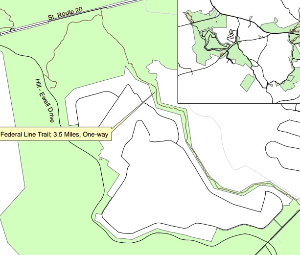
The Federal Line Trail. Source: National Park Service Trail Brochure.
The Wilderness Battlefield features several hiking trails. I decided to start my day by exploring one I've never hiked, the Federal Line Trail, with Gordon Rhea's The Battle of the Wilderness in hand. This 3.6 mile (one way) trail winds along the remnants of the Army of the Potomac's earthworks that stretch between the Orange Turnpike (modern Route 20) and the Orange Plank Road. The trail head is located on Hill - Ewell Drive at a picnic area between stops 3 and 4 of the driving tour.

Confederate earthworks along the start of the start of the trail.
It begins along the main Confederate line of battle and follows a northeasterly direction toward the Orange Turnpike. Through these woods on the afternoon of May 5th the men of Gouvernour K. Warren's Union 5th Corps rolled forward on their way to assault Richard Ewell's men south of the Turnpike, and were repulsed.

Snow-covered earthworks of the Union 5th Corps.
Once the trail nears the turnpike, it turns sharply south and begins to wind along the remnants of entrenchments built by 5th Corps. The veterans built these works along a ridge line west of the Lacy Plantation clearing, where Warren had set up his headquarters. The earthen fortifications are in a pretty decent state of preservation, and white snow still clung to the mounds in places where the sun struggled the penetrate the Wilderness's canopy.

If you look closely you can see the half-moon shape of a lunette fortification here, built to protect an artillery piece supporting Warren's battle line.
Among the remains of the battle here are twelve lunettes dug to protect artillery pieces. Though the pieces were positioned along a fairly prominent ridge line, the dense foliage likely prevented the guns from having any significant effect in the battle.

The descent into the Wilderness Run Valley.
Eventually, the trail descends rapidly into a beautiful ravine cut by Mill Branch, or North Wilderness Run. The trail crosses over the small stream on a recently built foot bridge, ascends a slight ridge, and then descends again into a ravine through which Wilderness Run cuts through. This area seemed to me one of the battlefield's hidden gem locations in terms of obscurity and beauty, and it also gave me a new appreciation for the difficulties faced by the Federal troops during the battle.

Mill Branch.
On the morning of May 5th, the lead elements of Warren's 5th corps broke their camps around Wilderness Tavern. They left the Turnpike near the Lacy Plantation and blindly groped through this area, slogging along a narrow wagon path that cut through the ravines and lowlands toward Parker's Store, several miles to the southwest. Eventually, Warren's lead division emerged from the thickets on the high ground of the Chewning Farm, a clearing that if held, would have prevented the Confederate army's two wings from linking up. With arrival along the Turnpike of Confederate troops, this division later abandoned the strategically important position to link up with the rest of the 5th Corps attacking to the north. On May 6th, the men of the Union 9th Corps also plunged through the ravines of Wilderness Run in a vain effort to exploit the gap that existed between the two Confederate wings.

Modern footbridge over Wilderness Run, supported by stone abutments from an older structure.

Wilderness Run.
South of Wilderness Run, the Federal Line Trail narrows, along with the NPS Boundary lines. The path continues to follow Union earthworks, but the works run essentially through the backyards of housing developments.

Here the park land runs close up to housing development.
I considered pressing forward to complete the entirety of the trail, which round-trip would have been a hike of over seven miles, but I instead chose to return to my car and explore a few other areas of the battlefield.

I made two quick stops at Auto Tour stops 4 & 5, the Higgerson and Chewning Farms, both of which have fairly short paths that get you out of your car. Standing in the clearing on the Chewning Farm, you begin to contemplate the possibilities that may have existed had the 5th Corps maintained its hold on this vital position on May 5th. The commander of the division that took control of this farm was General Samuel W. Crawford. Assisted by Warren's aide Washington Roebling, Crawford argued unsuccessfully against orders to abandon the cleared heights. A more concerted effort to reinforce Crawford and hold the Chewning Farm perhaps could have permanently split the two wings of Lee's army, allowing the Army of the Potomac to deal with each in turn. It is up to debate however, whether such an opportunity truly existed.

Looking north from the Chewning Farm clearing toward the Turnpike.
After a brief lunch, I returned to the battlefield to explore a more commonly visited locale, Saunders Field. Rhea's book in hand I followed the path of the 5th Corps's noon-time assault across this field that met such a slaughter, and then moved on to take in the view from the Confederate lines opposite.

Looking back across Saunders Field from the Confederate perspective. The small white monument in the center-left distance is a memorial honoring the 140th New York.
All in all, I had a pleasant spring day on the battlefield. The Federal Line Trail is definitely something to check out if you want to explore an area of the Wilderness not often seen by general visitors. A word of caution however - the trail does not currently feature interpretive signage, and no NPS walking tour brochure exists as of yet. If you plan to try out this trail, you will need to bring your own maps and resources. Rhea's book is a great option.

Tuesday, February 4, 2014

Following the Assault on Marye's Heights

Fredericksburg from Chatham Manor.
Sunday turned into a sunny, 65 degree here in Virginia - the kind of February weather I could get used to after living in Central New York for seven years. Emily and I decided to take advantage of the weather to make a visit to a battlefield. My wife is a fan of strolling through historic urban landscapes, and so I thought Fredericksburg offered the perfect setting to combine both of our interests. This visit marked my fifth to the Fredericksburg battlefield, and my first in about ten years. On all of my previous visits I crammed multiple battlefields into one day. Now that we live a short drive away, though, we decided to take our time. We ended up spending our whole day focused on the battle for the city and the assault on Marye's Heights, leaving Jackson's front for another day.

While the National Park Service preserves the Confederate positions along the sunken road, development took over the open fields through which the Army of the Potomac advanced against the heights long ago. I remember feeling disappointed on my first few visits by how little you could visualize standing along the stonewall. As a result, I spent most of my time elsewhere, studying the ground along Jackson's lines, or moving on to Chancellorsville.

Getting a good sense of the assault on Marye's Heights takes some work, but it can be done. You can find interpretive signage throughout the town, and the NPS has developed two excellent walking tour scripts, "Fire in the Streets" and "Assault on Marye's Heights," which you can download for free online. We however decided to make use of the Civil War Preservation Trust's Fredericksburg Battle App. The App has four tours total; we focused our attention on tour (1), "The Fight for the Town," and tour (3), "Marye's Heights." Each tour features excellent, GPS enabled maps that help you move from stop to stop, while each stop has a detailed description of what happened there, often including audio clips of first-hand accounts and videos of Park Rangers interpreting the combat. The Trust's Battle Apps are free to download, and an excellent resource to have with you if you own a smart phone.


We began our visit on the opposite side of the Rappahannock River at Chatham. The Georgian mansion built between 1768 and 1771 overlooks the city of Fredericksburg atop Stafford Heights. We were the first visitors of the day, and an enthusiastic volunteer greeted us as we entered, and happily answered any questions that we had as we toured the exhibits inside the house. The overlook on the river side of the house is the perfect place to explain Burnside's plan, the attempt to build the pontoon bridges, and the bombardment of the city on December 11th.

After spending a good 45 minutes at Chatham, we jumped into our car, took a short drive over the Chatham Bridge into the historic downtown and parked our car in a public parking lot along Sophia Street. We spent the rest of the day on foot. We strolled down Sophia Street to the site of the upper crossing site, and learned about the river assault of the 7th Michigan. Our path then turned left, up Hawke Street, following the soldiers of the 7th Michigan, along with the 19th and 20th Massachusetts. In the intersection of Hawke and Caroline Streets, we paused to hear NPS Ranger Frank O'Reilly recount the 20th Massachusetts' bloody encounter with William Barksdale's Missippians.

Photo taken at the upper crossing site, utilizing the Fredericksburg App's augmented reality "Field Glasses" feature.
The tour route then took us down Princess Anne Street, past many prominent buildings that stood in 1862, as we continued to learn about the urban combat of December 11th, the flight of terrified civilians, and the looting of the wrecked town that began that evening. At George Street, we turned right and began to make our way towards what would have been the edge of town in December of 1862. At Hurkamp Park we reached stop one of our second tour, the assault on Marye's Heights. This tour traced the route of the Army of the Potomac's multiple assaults against the heights on December 13th, leading us along George and Hanover Streets. While the development of the city has destroyed much of the distinctive landscape of the battlefield, such as the mill race federal soldiers had to cross under artillery fire, other features remain despite the development. The App and interpretive signage along the route did a nice job of pointing out the location of rises of ground and swales that still exist today and served as limited cover for the federal assault columns.

The Sunken Road.
We paused our tour for a quick, inexpensive, but excellent lunch at the Sunken Well Tavern at the corner of Hanover and Littlepage, the site of Sisson's Store during the battle, and continued our hike past the Stratton House and up Mercer Street. Here soldiers from the 12th New Hampshire made it as far as any federal soldiers, about fifty yards from the stonewall. Finally, after a mile or so of hiking, we arrived at the Sunken Road and NPS land. We toured the Confederate infantry posts at the base of Marye's Heights, climbed the hill to view their artillery positions, and took a brief stroll through the National Cemetery before looping back around to begin our march back into the historic downtown. We concluded our day with a stop at Hyperion Expresso on the corner of Princess Anne and William Streets, a excellent spot that fueled us for the drive back to Charlottesville.

While you have to use your imagination along the way, you can still get a sense of the terrain and obstacles that made the assault against Marye's Heights such a disastrous undertaking. If you have the time to spend, and feel up for a walk of two to three miles, it will give you a better appreciation for the assault on Marye's Heights from Union perspective.

Saturday, October 12, 2013

A Hike on the Payne's Farm Interpretive Trail


The misting rains continued today, dampening everything, but not quite enough to deter outdoor activities. This morning I took a drive over to Locust Grove, Virginia to check out the Payne's Farm Battlefield. This battle was the largest engagement during the Mine Run Campaign of November, 1863. It pitted Edward "Allegheny" Johnson's Confederate division against the Third Corps of the Army of the Potomac. Over the years the battle, and the Mine Run Campaign as a whole, has received little attention. And yet, due to its rural, agricultural surroundings, the battlefield has survived untouched by modern intrusions. The Civil War Trust and the Piedmont Environmental Council purchased the land in 2003, and in 2011 the Trust opened a 1.5 mile interpretive trail to allow visitors to explore the site.  The trail begins at the Zoar Baptist Church on State Route 611, 2.4 miles north of Route 20. The church allows visitors wishing to explore the trail to park in its parking lot (special arrangements must be made on Sundays).

A close look at the 1.5 mile interpretive trail loop.

The trail begins on the opposite side of the Raccoon Ford Road from the church and starts off moving northwest, paralleling the Raccoon Ford Road until it reaches an intersection with the Jacob's Ford Road.


On the afternoon of November 27th, Union skirmishers approaching the intersection along Jacob's Ford Road (from the camera's right) opened fire on the tail of Edward Johnson's Confederate division, which was passing along the road pictured from right to left. Brigadier General George H. Steuart commanded the final brigade in Johnson's column. Steuart halted his command around the intersection, formed it into a line of battle in the road, and then advanced into the woods to engage the federals. Johnson quickly surveyed the situation and had the rest of his division countermarch to the developing engagement. He did not know that he faced an entire army corps.

From this stop, the trail turns northward and moves through the woods while paralleling the Jacob's Ford Road. As I made my way along the trail, I found only one other soul making use of it on this rainy morning.

The only creature I shared the battlefield with on this damp day.

The initial engagement between Steuart's brigade and Union General Henry Prince's second division of the Third Corps eventually bogged down into a stalemate in the thick woods. Meanwhile, reinforcements made their way to the field.  On the Union side, General Joseph Carr's third division arrived on the scene and moved into position on Prince's left flank, just as Johnson was attempting to turn it. The trail here turns sharply eastward to follow the advance of Carr's three brigades. For most of Carr's men, this would be their first true taste of battle.


The trail follows a small foot bridge across a stream, and then follows the advance of Carr's men up this steep ridge.

Carr's men advanced through the difficult terrain down into a shallow depression, across a small stream, and then up a steep ridge, pushing back a thick line of Confederate skirmishers. After making it to the top of the rise they took a position along a worm fence at the edge of the woods, overlooking open fields. From this position, they beat back several Confederate assaults.

At the top of the ridge, the trail arrives at the edge of the woods and looks out into this field. During the battle a worm fence ran along the woods' edge, and Carr's men made the most of this strong defensive position.

From this point, the trail turns southeast and makes its way to farm lane of Madison Payne, who owned the farm that gave this battle its name. As the battle progressed, Confederates established their main line of battle in Mr. Payne's lane, and launched several uncoordinated and unsuccessful assaults across his fields toward Carr's men positioned in the woods beyond.

This image looks across the open field towards the woods occupied by the Third Corps from the Confederate position in Payne's Farm lane.

The Payne Farm can be seen here in the distance, and the farm lane runs along the right side of this image.

After dark, the Confederates fell back to Raccoon Ford Road, and eventually the main Confederate position being set up behind Mine Run. Johnson's assault against the Third Corps was technically not successful, but it delayed a significant portion of the Army of the Potomac for an entire afternoon, and gave General Lee much needed time to set up an impressive defensive position behind Mine Run. The strength of Lee's position doomed Meade's campaign to failure.

The 1.5 mile Payne's Farm loop takes about an hour to an hour and a half to complete if you plan on reading all of the interpretive signs (which are well done). Later this week I'll take a more detailed look at this battle as I continue my series on French's Pets. If you can't make it yourself to explore the Payne's Farm battlefield, enjoy this nicely done video tour from the Civil War Trust's Garry Adelman:


4 Minutes at Payne's Farm from Civil War Trust on Vimeo.